
Hünxe topographic map
Interactive map
Click on the map to display elevation.
About this map
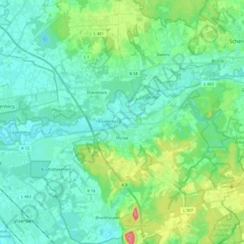
Name: Hünxe topographic map, elevation, terrain.
Location: Hünxe, Kreis Wesel, Noordrijn-Westfalen, 46569, Duitsland (51.58517 6.66941 51.71415 6.87155)
Average elevation: 40 m
Minimum elevation: 19 m
Maximum elevation: 114 m