
Thank you for supporting this site ❤️
Make a donation
Make a donation
Doi Saket topographic map
Click on the map to display elevation.
Thank you for supporting this site ❤️
Make a donation
Make a donation
About this map
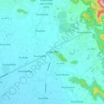
Name: Doi Saket topographic map, elevation, terrain.
Location: Doi Saket, Luang Nuea, Chiang Mai Province, Thailand (18.83319 99.09657 18.91319 99.17657)
Average elevation: 343 m
Minimum elevation: 313 m
Maximum elevation: 633 m
Thank you for supporting this site ❤️
Make a donation
Make a donation
Other topographic maps
Click on a map to view its topography, its elevation and its terrain.