
Thank you for supporting this site ❤️
Make a donation
Make a donation
Biestow topographic map
Click on the map to display elevation.
Thank you for supporting this site ❤️
Make a donation
Make a donation
About this map
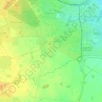
Name: Biestow topographic map, elevation, terrain.
Average elevation: 39 m
Minimum elevation: 22 m
Maximum elevation: 53 m
Thank you for supporting this site ❤️
Make a donation
Make a donation
Other topographic maps
Click on a map to view its topography, its elevation and its terrain.
Rostock
Deutschland > Mecklenburg-Vorpommern > Rostock
Rostocks größte Ausdehnung von Nord nach Süd beträgt 21,6 km und von Ost nach West 19,4 km. Die Länge der Stadtgrenze (ohne Küste) beträgt 97,9 km. Rostocks Küste selbst hat eine Länge von 18,5 km. Die Warnow im Stadtgebiet erstreckt sich über 16 km. Der höchste Punkt in der Stadt mit etwa 49 m ü.…
Average elevation: 23 m
Thank you for supporting this site ❤️
Make a donation
Make a donation