
Thank you for supporting this site ❤️
Make a donation
Make a donation
Frankfort topographic map
Click on the map to display elevation.
Thank you for supporting this site ❤️
Make a donation
Make a donation
About this map
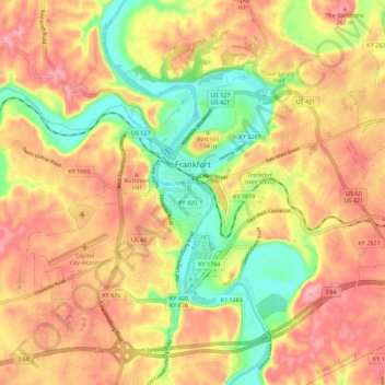
Name: Frankfort topographic map, elevation, terrain.
Location: Frankfort, Franklin County, Kentucky, United States (38.15784 -84.92145 38.23105 -84.80961)
Average elevation: 216 m
Minimum elevation: 139 m
Maximum elevation: 277 m
Thank you for supporting this site ❤️
Make a donation
Make a donation
Other topographic maps
Click on a map to view its topography, its elevation and its terrain.