
Wisenta topographic map
Interactive map
Click on the map to display elevation.
About this map
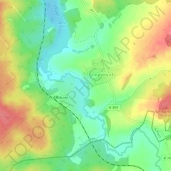
Name: Wisenta topographic map, elevation, terrain.
Average elevation: 482 m
Minimum elevation: 450 m
Maximum elevation: 520 m
Other topographic maps
Click on a map to view its topography, its elevation and its terrain.
Hohe Warte
Deutschland > Thüringen > Schleiz
Hohe Warte, Schleiz, Saale-Orla-Kreis, Thüringen, 07907, Deutschland
Average elevation: 485 m
Hirschraufe
Deutschland > Thüringen > Schleiz
Hirschraufe, Schleiz, Saale-Orla-Kreis, Thüringen, Deutschland
Average elevation: 533 m