
Arnheim topographic map
Interactive map
Click on the map to display elevation.
About this map
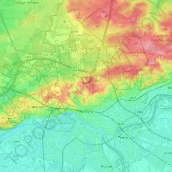
Name: Arnheim topographic map, elevation, terrain.
Location: Arnheim, Geldern, Niederlande (51.93346 5.80296 52.07789 5.99034)
Average elevation: 38 m
Minimum elevation: 1 m
Maximum elevation: 106 m
Other topographic maps
Click on a map to view its topography, its elevation and its terrain.