
Gunung Hiri topographic map
Interactive map
Click on the map to display elevation.
About this map
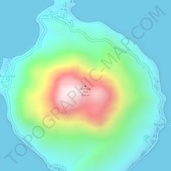
Name: Gunung Hiri topographic map, elevation, terrain.
Location: Gunung Hiri, Ternate, Moluques du Nord, Indonésie (0.89787 127.31842 0.89797 127.31852)
Average elevation: 157 m
Minimum elevation: 0 m
Maximum elevation: 640 m
Other topographic maps
Click on a map to view its topography, its elevation and its terrain.
Todoko-Ranu
Indonésie > Moluques du Nord > Ternate
Todoko-Ranu, Ternate, Moluques du Nord, Indonésie
Average elevation: 717 m