
Schneeberg topographic map
Interactive map
Click on the map to display elevation.
About this map
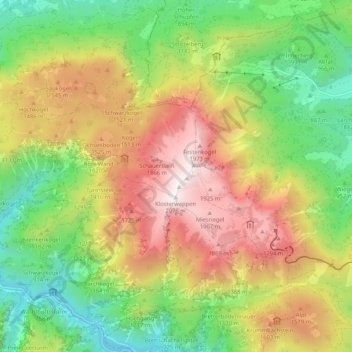
Name: Schneeberg topographic map, elevation, terrain.
Average elevation: 1,201 m
Minimum elevation: 526 m
Maximum elevation: 2,068 m
Other topographic maps
Click on a map to view its topography, its elevation and its terrain.
Losenheim
Autriche > Basse-Autriche > Bezirk Neunkirchen > Gemeinde Puchberg am Schneeberg > Losenheim
Average elevation: 970 m