
Thank you for supporting this site ❤️
Make a donation
Make a donation
Avaredalu topographic map
Click on the map to display elevation.
Thank you for supporting this site ❤️
Make a donation
Make a donation
About this map
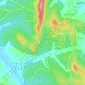
Name: Avaredalu topographic map, elevation, terrain.
Location: Avaredalu, Somawarpet taluk, Kodagu, Karnataka, 571231, India (12.73305 75.88525 12.77305 75.92525)
Average elevation: 953 m
Minimum elevation: 902 m
Maximum elevation: 1,068 m
Thank you for supporting this site ❤️
Make a donation
Make a donation