
Streatham topographic map
Interactive map
Click on the map to display elevation.
About this map
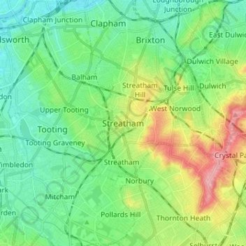
Name: Streatham topographic map, elevation, terrain.
Location: Streatham, Londen, Greater London, Engeland, SW16 1QR, VK (51.38977 -0.17111 51.46977 -0.09111)
Average elevation: 37 m
Minimum elevation: 1 m
Maximum elevation: 119 m