
Hüllstede topographic map
Interactive map
Click on the map to display elevation.
About this map
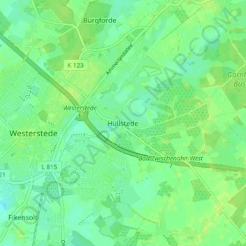
Name: Hüllstede topographic map, elevation, terrain.
Location: Hüllstede, Ammerland, Niedersachsen, 26655, Deutschland (53.23912 7.93167 53.27912 7.97167)
Average elevation: 9 m
Minimum elevation: 2 m
Maximum elevation: 14 m