
Ceredigion topographic map
Interactive map
Click on the map to display elevation.
About this map
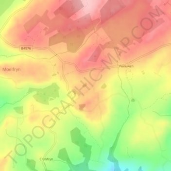
Name: Ceredigion topographic map, elevation, terrain.
Location: Ceredigion, Gales, Reino Unido (52.24267 -4.06724 52.24279 -4.06704)
Average elevation: 282 m
Minimum elevation: 187 m
Maximum elevation: 343 m
Other topographic maps
Click on a map to view its topography, its elevation and its terrain.
Welshpool
Reino Unido > Gales > Welshpool
Welshpool, Powys, Gales, SY21, Reino Unido
Average elevation: 156 m