
Thank you for supporting this site ❤️
Make a donation
Make a donation
University topographic map
Click on the map to display elevation.
Thank you for supporting this site ❤️
Make a donation
Make a donation
About this map
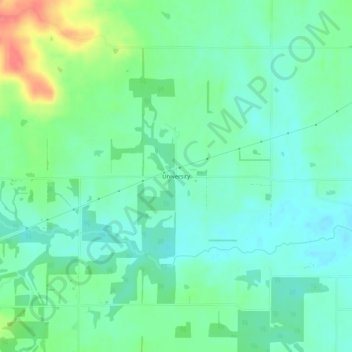
Name: University topographic map, elevation, terrain.
Location: University, Hamilton County, Illinois, United States (37.91644 -88.62950 37.95644 -88.58950)
Average elevation: 137 m
Minimum elevation: 120 m
Maximum elevation: 179 m
Thank you for supporting this site ❤️
Make a donation
Make a donation
Other topographic maps
Click on a map to view its topography, its elevation and its terrain.