
Crespiat topographic map
Interactive map
Click on the map to display elevation.
About this map
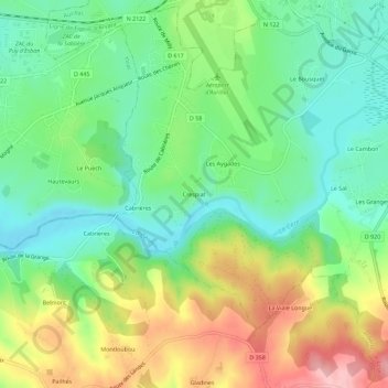
Name: Crespiat topographic map, elevation, terrain.
Average elevation: 630 m
Minimum elevation: 568 m
Maximum elevation: 733 m
Other topographic maps
Click on a map to view its topography, its elevation and its terrain.
Lapeyrusse
France > Auvergne-Rhône-Alpes > Cantal > Arpajon-sur-Cère
Lapeyrusse, Arpajon-sur-Cère, Aurillac, Cantal, Auvergne-Rhône-Alpes, France métropolitaine, 15130, France
Average elevation: 643 m