
Thank you for supporting this site ❤️
Make a donation
Make a donation
Mkunumbi topographic map
Click on the map to display elevation.
Thank you for supporting this site ❤️
Make a donation
Make a donation
About this map
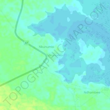
Name: Mkunumbi topographic map, elevation, terrain.
Location: Mkunumbi, Mkunumbi ward, Lamu West, Lamu, Kenya (-2.32309 40.68312 -2.28309 40.72312)
Average elevation: 5 m
Minimum elevation: 0 m
Maximum elevation: 14 m
Thank you for supporting this site ❤️
Make a donation
Make a donation