
Thank you for supporting this site ❤️
Make a donation
Make a donation
Huadu District topographic map
Click on the map to display elevation.
Thank you for supporting this site ❤️
Make a donation
Make a donation
About this map
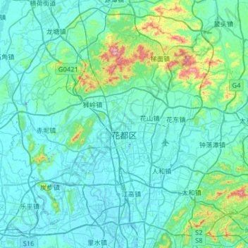
Name: Huadu District topographic map, elevation, terrain.
Location: Huadu District, Guangzhou City, Guangdong Province, China (23.23366 112.95237 23.61859 113.47054)
Average elevation: 56 m
Minimum elevation: -19 m
Maximum elevation: 537 m
Thank you for supporting this site ❤️
Make a donation
Make a donation
Other topographic maps
Click on a map to view its topography, its elevation and its terrain.