
Thank you for supporting this site ❤️
Make a donation
Make a donation
Arnoldsburg topographic map
Click on the map to display elevation.
Thank you for supporting this site ❤️
Make a donation
Make a donation
Arnoldsburg
Arnoldsburg (also Arnoldsburgh) is an unincorporated community in Calhoun County, West Virginia, United States. It lies along U.S. Route 33 at the point where West Virginia Route 16 heads southward; it is several miles south of the county seat of Grantsville. Its elevation is 738 feet (225 m). The West Fork Little Kanawha River flows through the community. It has a post office with the ZIP code 25234.
Thank you for supporting this site ❤️
Make a donation
Make a donation
About this map
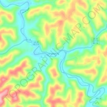
Name: Arnoldsburg topographic map, elevation, terrain.
Average elevation: 287 m
Minimum elevation: 213 m
Maximum elevation: 389 m
Thank you for supporting this site ❤️
Make a donation
Make a donation
Other topographic maps
Click on a map to view its topography, its elevation and its terrain.