
Thank you for supporting this site ❤️
Make a donation
Make a donation
Lithabaneng topographic map
Click on the map to display elevation.
Thank you for supporting this site ❤️
Make a donation
Make a donation
About this map
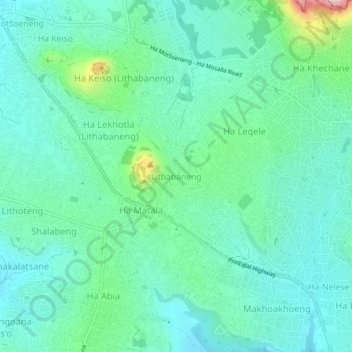
Name: Lithabaneng topographic map, elevation, terrain.
Location: Lithabaneng, Maseru District, 160, Lesotho (-29.38520 27.52090 -29.34520 27.56090)
Average elevation: 1,605 m
Minimum elevation: 1,538 m
Maximum elevation: 1,856 m
Thank you for supporting this site ❤️
Make a donation
Make a donation
Other topographic maps
Click on a map to view its topography, its elevation and its terrain.