
Fingal topographic map
Interactive map
Click on the map to display elevation.
About this map
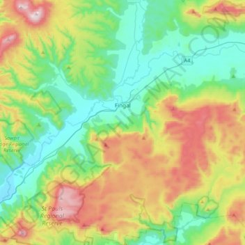
Name: Fingal topographic map, elevation, terrain.
Location: Fingal, Break O'Day, Tasmania, Australia (-41.78027 147.77297 -41.53390 148.08373)
Average elevation: 487 m
Minimum elevation: 204 m
Maximum elevation: 1,078 m
Other topographic maps
Click on a map to view its topography, its elevation and its terrain.