
Thank you for supporting this site ❤️
Make a donation
Make a donation
Bohol topographic map
Click on the map to display elevation.
Thank you for supporting this site ❤️
Make a donation
Make a donation
About this map
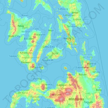
Name: Bohol topographic map, elevation, terrain.
Location: Bohol, Central Visayas, Philippines (7.27333 121.60156 12.39333 126.72156)
Average elevation: 118 m
Minimum elevation: -2 m
Maximum elevation: 2,797 m
Thank you for supporting this site ❤️
Make a donation
Make a donation