
Thank you for supporting this site ❤️
Make a donation
Make a donation
Braggio topographic map
Click on the map to display elevation.
Thank you for supporting this site ❤️
Make a donation
Make a donation
Braggio
The former municipality is located in the Calanca sub-district of the Moesa district on the left side of the Val Calanca. It is on a high meadow at an elevation of 1,320 m (4,330 ft) and can only be reached via a cable car (since 1961) or a narrow footpath.
Thank you for supporting this site ❤️
Make a donation
Make a donation
About this map
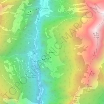
Name: Braggio topographic map, elevation, terrain.
Location: Braggio, Arvigo, Calanca, Moësa, Grisons, 6544, Switzerland (46.28335 9.10421 46.32335 9.14421)
Average elevation: 1,521 m
Minimum elevation: 755 m
Maximum elevation: 2,613 m
Thank you for supporting this site ❤️
Make a donation
Make a donation