
Thank you for supporting this site ❤️
Make a donation
Make a donation
BONDE topographic map
Click on the map to display elevation.
Thank you for supporting this site ❤️
Make a donation
Make a donation
About this map
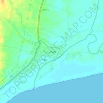
Name: BONDE topographic map, elevation, terrain.
Location: BONDE, Polewali Mandar, West Sulawesi, Sulawesi, Indonesia (-3.49900 119.12550 -3.45900 119.16550)
Average elevation: 7 m
Minimum elevation: 0 m
Maximum elevation: 32 m
Thank you for supporting this site ❤️
Make a donation
Make a donation
Other topographic maps
Click on a map to view its topography, its elevation and its terrain.