
Thank you for supporting this site ❤️
Make a donation
Make a donation
Cumming topographic map
Click on the map to display elevation.
Thank you for supporting this site ❤️
Make a donation
Make a donation
About this map
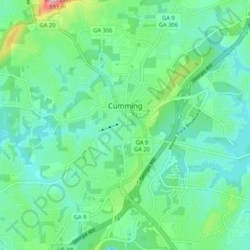
Name: Cumming topographic map, elevation, terrain.
Location: Cumming, Forsyth County, Georgia, United States (34.17157 -84.15790 34.23348 -84.09581)
Average elevation: 365 m
Minimum elevation: 313 m
Maximum elevation: 544 m
Thank you for supporting this site ❤️
Make a donation
Make a donation
Other topographic maps
Click on a map to view its topography, its elevation and its terrain.
Sawnee Mountain
United States > Georgia > Forsyth County
Sawnee Mountain is a low mountain between the piedmont and Appalachian foothills of the U.S. state of Georgia, north of Atlanta. Average rainfall/46.26in/yr/ average snowfall/5.7in/yr/. The name Sawnee Mountain actually refers to the entire ridge of approximately five miles (8 km) in length. At its summit, the…
Average elevation: 404 m
Thank you for supporting this site ❤️
Make a donation
Make a donation