
Thank you for supporting this site ❤️
Make a donation
Make a donation
Ibergeregg topographic map
Click on the map to display elevation.
Thank you for supporting this site ❤️
Make a donation
Make a donation
About this map
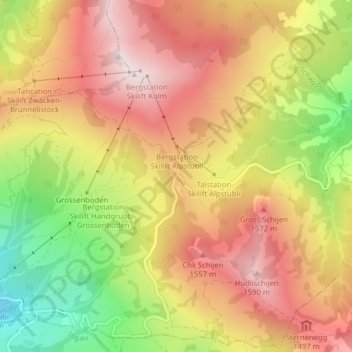
Name: Ibergeregg topographic map, elevation, terrain.
Location: Ibergeregg, Schwytz, Schwyz, 6434, Suisse (47.01738 8.73316 47.01748 8.73326)
Average elevation: 1,367 m
Minimum elevation: 1,068 m
Maximum elevation: 1,591 m
Thank you for supporting this site ❤️
Make a donation
Make a donation