
Thank you for supporting this site ❤️
Make a donation
Make a donation
Lambo topographic map
Click on the map to display elevation.
Thank you for supporting this site ❤️
Make a donation
Make a donation
About this map
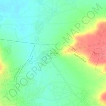
Name: Lambo topographic map, elevation, terrain.
Location: Lambo, Tsaki Walakae, Kware, Sokoto State, Nigeria (13.03193 5.28624 13.07193 5.32624)
Average elevation: 269 m
Minimum elevation: 246 m
Maximum elevation: 310 m
Thank you for supporting this site ❤️
Make a donation
Make a donation