
Thank you for supporting this site ❤️
Make a donation
Make a donation
La Californie topographic map
Click on the map to display elevation.
Thank you for supporting this site ❤️
Make a donation
Make a donation
About this map
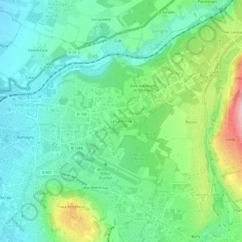
Name: La Californie topographic map, elevation, terrain.
Average elevation: 493 m
Minimum elevation: 433 m
Maximum elevation: 641 m
Thank you for supporting this site ❤️
Make a donation
Make a donation
Other topographic maps
Click on a map to view its topography, its elevation and its terrain.
Près des plans
France > Auvergne-Rhône-Alpes > Haute-Savoie > Ville-la-Grand > Les Vercheres
Average elevation: 471 m