
Thank you for supporting this site ❤️
Make a donation
Make a donation
Pudur topographic map
Click on the map to display elevation.
Thank you for supporting this site ❤️
Make a donation
Make a donation
About this map
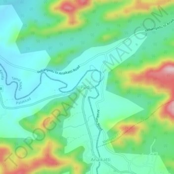
Name: Pudur topographic map, elevation, terrain.
Location: Pudur, Mannarkad, Palakkad, Kerala, 678741, India (11.11277 76.72495 11.15277 76.76495)
Average elevation: 606 m
Minimum elevation: 517 m
Maximum elevation: 823 m
Thank you for supporting this site ❤️
Make a donation
Make a donation
Other topographic maps
Click on a map to view its topography, its elevation and its terrain.