
Thank you for supporting this site ❤️
Make a donation
Make a donation
Gandria topographic map
Click on the map to display elevation.
Thank you for supporting this site ❤️
Make a donation
Make a donation
About this map
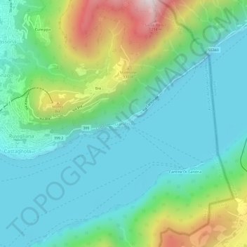
Name: Gandria topographic map, elevation, terrain.
Location: Gandria, Lugano, Distretto di Lugano, Ticino, 6978, Switzerland (45.98574 8.98278 46.02574 9.02278)
Average elevation: 533 m
Minimum elevation: 245 m
Maximum elevation: 1,370 m
Thank you for supporting this site ❤️
Make a donation
Make a donation
Other topographic maps
Click on a map to view its topography, its elevation and its terrain.