Geolocate

Bergamo topographic map

Interactive map

Click on the map to display elevation.

About this map

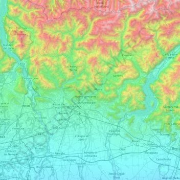
Name: Bergamo topographic map, elevation, terrain.

Location: Bergamo, Lombardy, Italy (45.42216 9.44505 46.09120 10.26275)

Average elevation: 697 m

Minimum elevation: 80 m

Maximum elevation: 3,014 m

Other topographic maps

Click on a map to view its topography, its elevation and its terrain.

Osmate

Italy > Lombardy > Varese

Average elevation: 287 m

Acquaseria

Italy > Lombardy > Como > San Siro

Average elevation: 442 m

Triulzo Inferiore

Italy > Lombardy > Milan > San Donato Milanese > Triulzo

Average elevation: 105 m

La Pare

Italy > Lombardy > Livigno

Average elevation: 2,017 m

Linate

Italy > Lombardy > Linate

Average elevation: 107 m

Almana

Italy > Lombardy > Polaveno

Average elevation: 677 m