Sungei Tampines topographic map
Interactive map
Click on the map to display elevation.
About this map
![Sungei Tampines topographic map, elevation, terrain](/pub/maps/way/rwnx/w9hj95nx/thumbnail.jpg)
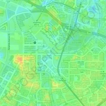
Name: Sungei Tampines topographic map, elevation, terrain.
Location: Sungei Tampines, Tampines, Northeast, 520622, Singapore (1.36063 103.94190 1.36070 103.94241)
Average elevation: 18 m
Minimum elevation: 3 m
Maximum elevation: 34 m
Other topographic maps
Click on a map to view its topography, its elevation and its terrain.
![Compassvale Ancilla Park topographic map, elevation, terrain](/pub/maps/way/hxgp/nlnzg14/icon.jpg)
Compassvale Ancilla Park
Singapore > Northeast > Singapore
Compassvale Ancilla Park, Compassvale, Seng Kang, Singapore, Northeast, Singapore
Average elevation: 17 m
![Bedok Reservoir topographic map, elevation, terrain](/pub/maps/way/hm2/nbljmt/icon.jpg)
Bedok Reservoir
Bedok Reservoir, Bedok, Northeast, Singapore
Average elevation: 23 m
![Lorong Halus topographic map, elevation, terrain](/pub/maps/way/sqtp/12htqvm2/icon.jpg)
Lorong Halus
Lorong Halus, Pasir Ris, Northeast, Singapore
Average elevation: 6 m
![Pasir Ris Town Park topographic map, elevation, terrain](/pub/maps/way/w657/mzzwx14/icon.jpg)
Pasir Ris Town Park
Pasir Ris Town Park, Pasir Ris, Northeast, 519500, Singapore
Average elevation: 14 m