
Thank you for supporting this site ❤️
Make a donation
Make a donation
Ratanpura topographic map
Click on the map to display elevation.
Thank you for supporting this site ❤️
Make a donation
Make a donation
About this map
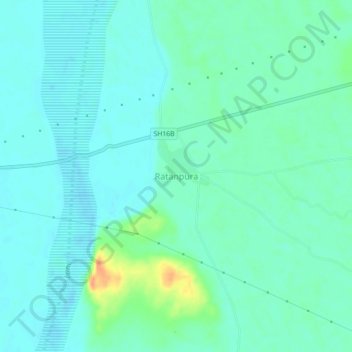
Name: Ratanpura topographic map, elevation, terrain.
Location: Ratanpura, Gudha Malani Tehsil, Barmer, Rajasthan, India (25.18331 71.75046 25.22331 71.79046)
Average elevation: 53 m
Minimum elevation: 44 m
Maximum elevation: 84 m
Thank you for supporting this site ❤️
Make a donation
Make a donation