
Perugia topographic map
Interactive map
Click on the map to display elevation.
About this map
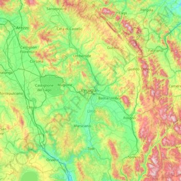
Name: Perugia topographic map, elevation, terrain.
Location: Perugia, Umbria, Italy (42.59682 11.91235 43.61734 13.26419)
Average elevation: 487 m
Minimum elevation: 68 m
Maximum elevation: 1,677 m
Other topographic maps
Click on a map to view its topography, its elevation and its terrain.