
Thank you for supporting this site ❤️
Make a donation
Make a donation
Mulhouse topographic map
Click on the map to display elevation.
Thank you for supporting this site ❤️
Make a donation
Make a donation
About this map
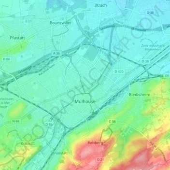
Name: Mulhouse topographic map, elevation, terrain.
Location: Mulhouse, Haut-Rhin, Grand Est, Metropolitan France, France (47.72188 7.28249 47.78337 7.36863)
Average elevation: 254 m
Minimum elevation: 229 m
Maximum elevation: 337 m
Thank you for supporting this site ❤️
Make a donation
Make a donation
Other topographic maps
Click on a map to view its topography, its elevation and its terrain.