
Thank you for supporting this site ❤️
Make a donation
Make a donation
Bonduel topographic map
Click on the map to display elevation.
Thank you for supporting this site ❤️
Make a donation
Make a donation
About this map
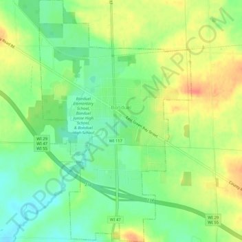
Name: Bonduel topographic map, elevation, terrain.
Location: Bonduel, Shawano County, Wisconsin, United States (44.72008 -88.46214 44.75636 -88.42991)
Average elevation: 277 m
Minimum elevation: 255 m
Maximum elevation: 301 m
Thank you for supporting this site ❤️
Make a donation
Make a donation
Other topographic maps
Click on a map to view its topography, its elevation and its terrain.