
New Forest topographic map
Interactive map
Click on the map to display elevation.
About this map
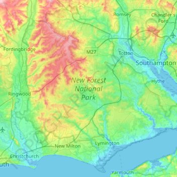
Name: New Forest topographic map, elevation, terrain.
Average elevation: 34 m
Minimum elevation: -4 m
Maximum elevation: 138 m
Other topographic maps
Click on a map to view its topography, its elevation and its terrain.
Fawley
VK > Engeland > New Forest
Fawley, New Forest, Hampshire, South East, Engeland, VK
Average elevation: 13 m