
Thank you for supporting this site ❤️
Make a donation
Make a donation
Pelton topographic map
Click on the map to display elevation.
Thank you for supporting this site ❤️
Make a donation
Make a donation
About this map
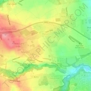
Name: Pelton topographic map, elevation, terrain.
Location: Pelton, County Durham, North East, England, United Kingdom (54.85776 -1.64207 54.87806 -1.59270)
Average elevation: 77 m
Minimum elevation: 20 m
Maximum elevation: 132 m
Thank you for supporting this site ❤️
Make a donation
Make a donation
Other topographic maps
Click on a map to view its topography, its elevation and its terrain.