
红河哈尼梯田 topographic map
Interactive map
Click on the map to display elevation.
About this map
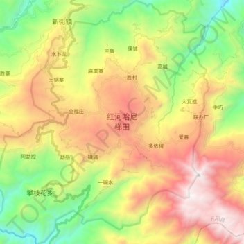
Name: 红河哈尼梯田 topographic map, elevation, terrain.
Location: 红河哈尼梯田, 主鲁, 元阳县, 红河哈尼族彝族自治州, Yunnan, Chine (23.02226 102.69587 23.17142 102.84256)
Average elevation: 1,585 m
Minimum elevation: 559 m
Maximum elevation: 2,849 m