
El Bancalejo topographic map
Interactive map
Click on the map to display elevation.
About this map
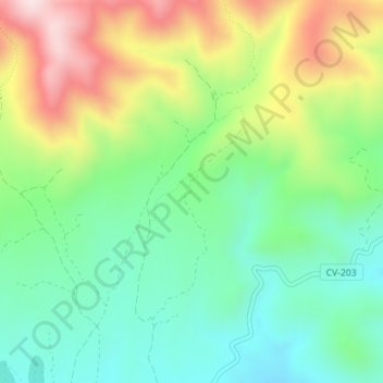
Name: El Bancalejo topographic map, elevation, terrain.
Average elevation: 792 m
Minimum elevation: 630 m
Maximum elevation: 1,072 m
Other topographic maps
Click on a map to view its topography, its elevation and its terrain.
Peña Vieja
España > Comunidad Valenciana > Caudiel
Peña Vieja, Caudiel, El Alto Palancia, Castellón, Comunidad Valenciana, 12440, España
Average elevation: 623 m