
Thank you for supporting this site ❤️
Make a donation
Make a donation
Nesjaryggen topographic map
Click on the map to display elevation.
Thank you for supporting this site ❤️
Make a donation
Make a donation
About this map
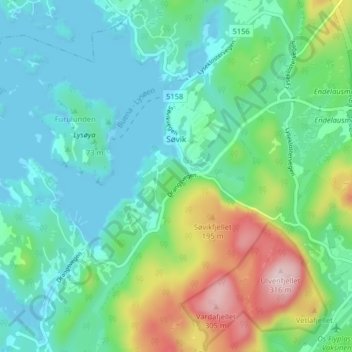
Name: Nesjaryggen topographic map, elevation, terrain.
Location: Nesjaryggen, Søvik, Bjørnafjorden, Vestland, 5215, Norge (60.18857 5.36421 60.22857 5.40421)
Average elevation: 77 m
Minimum elevation: -1 m
Maximum elevation: 304 m
Thank you for supporting this site ❤️
Make a donation
Make a donation