
Thank you for supporting this site ❤️
Make a donation
Make a donation
Kruh topographic map
Click on the map to display elevation.
Thank you for supporting this site ❤️
Make a donation
Make a donation
About this map
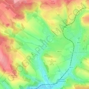
Name: Kruh topographic map, elevation, terrain.
Location: Kruh, okres Semily, Liberec Region, Northeast, Czechia (50.55041 15.46103 50.58251 15.49929)
Average elevation: 458 m
Minimum elevation: 402 m
Maximum elevation: 516 m
Thank you for supporting this site ❤️
Make a donation
Make a donation
Other topographic maps
Click on a map to view its topography, its elevation and its terrain.