
Thank you for supporting this site ❤️
Make a donation
Make a donation
Inukjuak (Village) topographic map
Click on the map to display elevation.
Thank you for supporting this site ❤️
Make a donation
Make a donation
About this map
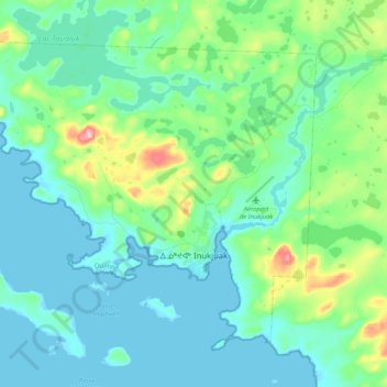
Name: Inukjuak (Village) topographic map, elevation, terrain.
Location: Inukjuak (Village), Kativik, Nord-du-Québec, Quebec, Canada (58.42695 -78.25490 58.51353 -78.04690)
Average elevation: 29 m
Minimum elevation: -1 m
Maximum elevation: 148 m
Thank you for supporting this site ❤️
Make a donation
Make a donation
Other topographic maps
Click on a map to view its topography, its elevation and its terrain.