
横須賀市 topographic map
Interactive map
Click on the map to display elevation.
About this map
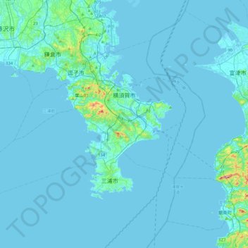
Name: 横須賀市 topographic map, elevation, terrain.
Location: 横須賀市, Prefectura de Kanagawa, 238-8550, Japón (35.11714 139.38333 35.34805 139.80178)
Average elevation: 13 m
Minimum elevation: -4 m
Maximum elevation: 298 m