
Les Portes topographic map
Interactive map
Click on the map to display elevation.
About this map
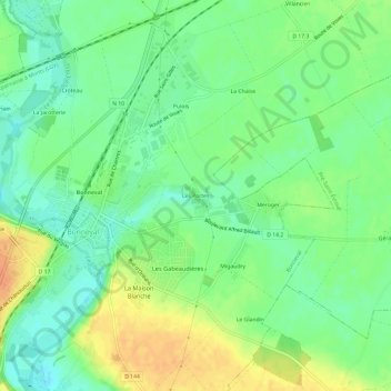
Name: Les Portes topographic map, elevation, terrain.
Average elevation: 134 m
Minimum elevation: 118 m
Maximum elevation: 155 m
Other topographic maps
Click on a map to view its topography, its elevation and its terrain.
Guibert
France > Centre-Val de Loire > Eure-et-Loir > Bonneval
Guibert, Bonneval, Châteaudun, Eure-et-Loir, Centre-Val de Loire, France métropolitaine, 28800, France
Average elevation: 148 m