
Thank you for supporting this site ❤️
Make a donation
Make a donation
Long Alango topographic map
Click on the map to display elevation.
Thank you for supporting this site ❤️
Make a donation
Make a donation
About this map
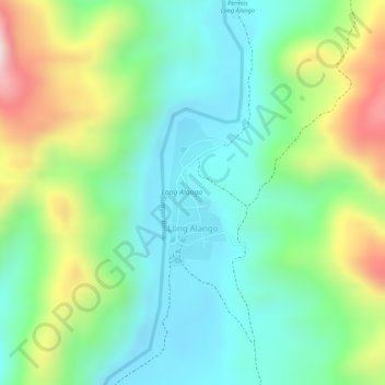
Name: Long Alango topographic map, elevation, terrain.
Location: Long Alango, Malinau, North Kalimantan, Kalimantan, Indonesia (2.91125 115.84637 2.92176 115.85049)
Average elevation: 477 m
Minimum elevation: 346 m
Maximum elevation: 728 m
Thank you for supporting this site ❤️
Make a donation
Make a donation
Other topographic maps
Click on a map to view its topography, its elevation and its terrain.