
Czerniaków topographic map
Interactive map
Click on the map to display elevation.
About this map
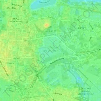
Name: Czerniaków topographic map, elevation, terrain.
Location: Czerniaków, Mokotów, Warsaw, Masovian Voivodeship, Poland (52.19172 21.04640 52.21665 21.07088)
Average elevation: 86 m
Minimum elevation: 73 m
Maximum elevation: 99 m
Other topographic maps
Click on a map to view its topography, its elevation and its terrain.
Warsaw
Poland > Masovian Voivodeship > Warsaw
Warsaw, Masovian Voivodeship, Poland
Average elevation: 95 m
Praga-Południe
Poland > Masovian Voivodeship > Warsaw
Praga-Południe, Warsaw, Warszawa, Masovian Voivodeship, Poland
Average elevation: 86 m