
Thank you for supporting this site ❤️
Make a donation
Make a donation
Elgin topographic map
Click on the map to display elevation.
Thank you for supporting this site ❤️
Make a donation
Make a donation
About this map
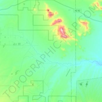
Name: Elgin topographic map, elevation, terrain.
Location: Elgin, Santa Cruz County, Arizona, United States (31.57759 -110.62089 31.72378 -110.45172)
Average elevation: 1,484 m
Minimum elevation: 1,350 m
Maximum elevation: 1,965 m
Thank you for supporting this site ❤️
Make a donation
Make a donation
Other topographic maps
Click on a map to view its topography, its elevation and its terrain.