
Thank you for supporting this site ❤️
Make a donation
Make a donation
David topographic map
Click on the map to display elevation.
Thank you for supporting this site ❤️
Make a donation
Make a donation
About this map
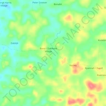
Name: David topographic map, elevation, terrain.
Location: David, District # 1, Grand Bassa County, Liberia (6.34287 -10.25535 6.38287 -10.21535)
Average elevation: 87 m
Minimum elevation: 58 m
Maximum elevation: 127 m
Thank you for supporting this site ❤️
Make a donation
Make a donation