
Ackendorf topographic map
Interactive map
Click on the map to display elevation.
About this map
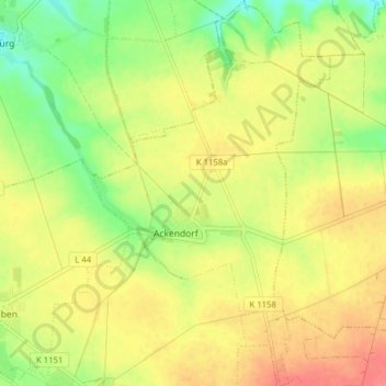
Name: Ackendorf topographic map, elevation, terrain.
Location: Ackendorf, Hohe Börde, Börde, Sachsen-Anhalt, Deutschland (52.20405 11.42132 52.25206 11.46949)
Average elevation: 102 m
Minimum elevation: 71 m
Maximum elevation: 129 m