
Make a donation
Anadarko topographic map
Click on the map to display elevation.
Make a donation
About this map
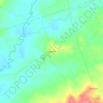
Name: Anadarko topographic map, elevation, terrain.
Location: Anadarko, Rusk County, Texas, United States (31.90822 -94.89633 31.94822 -94.85633)
Average elevation: 103 m
Minimum elevation: 80 m
Maximum elevation: 164 m
Make a donation
Other topographic maps
Click on a map to view its topography, its elevation and its terrain.
Mount Enterprise
United States > Texas > Rusk County
The city of Mount Enterprise, located south of Henderson in rural Rusk County, was named for a small elevation near the town and for the business enterprise of the Vinzent brothers, who settled it in 1832.
Average elevation: 140 m
Mount Enterprise
United States > Texas > Rusk County
The city of Mount Enterprise, located south of Henderson in rural Rusk County, was named for a small elevation near the town and for the business enterprise of the Vinzent brothers, who settled it in 1832.
Average elevation: 140 m
Make a donation