
བསང་ཆུ་རྫོང་ 夏河县 topographic map
Interactive map
Click on the map to display elevation.
About this map
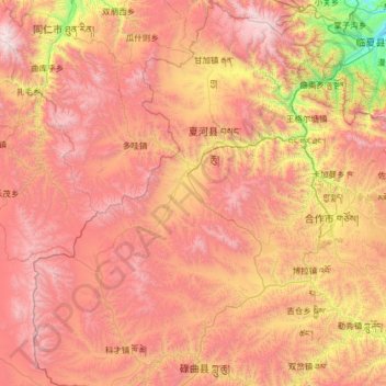
Name: བསང་ཆུ་རྫོང་ 夏河县 topographic map, elevation, terrain.
Location: བསང་ཆུ་རྫོང་ 夏河县, 甘南州, Gansu, RPC (34.53654 101.91499 35.59350 102.97374)
Average elevation: 3,407 m
Minimum elevation: 2,015 m
Maximum elevation: 4,765 m
Other topographic maps
Click on a map to view its topography, its elevation and its terrain.